
Stormy start to the holiday weekend

Hit and miss showers and storms return to KAKEland Friday and a few could be severe. While this is not an overly organized severe threat, storms that develop could produce large hail, high wind and even a few tornadoes.
Storms will likely fire up across Eastern Colorado during the mid to late afternoon and then track east toward KAKEland. Look for storms crossing into Kansas between 5 and 8 p.m. Like Thursday, storms that develop during the afternoon and evening across Western Kansas could produce hail topping one inch in diameter, wind gusts over 60 mph and even a few tornadoes.
Storms will continue their eastern progression through the evening. The main storm threat will shift to high wind as storms cross the I-135 corridor after midnight.
Storms will be possible after midnight in and around Wichita. If storms are severe, the most likely threat will be wind. These storms will exit KAKEland before sunrise.
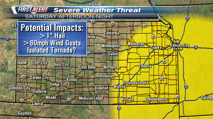
Saturday will bring another chance for spotty severe storms in the afternoon and evening. The most likely area for this severe weather activity will be east of the I-135/US-81 corridor. The most likely threat with storms on Saturday will be large hail over one inch, wind over 60 mph and even an isolated tornado. Storms will exit KAKEland during the late evening hours.
Sunday and Memorial Day will be dry, mostly sunny and warm.
Stay tuned for updates and alerts as this forecast evolves. We’ll keep you up to date with our Interactive Radar and LIVE weather coverage. Get those features and more on the free First Alert Weather App. With the app you can track storms in your area, stream the latest forecast videos and live severe weather coverage, and set customized alerts to keep you and your family informed and safe.
In the event of severe weather, click here to follow KAKE First Alert Storm Trackers in the field.
